- Home
- See Awesome Sights
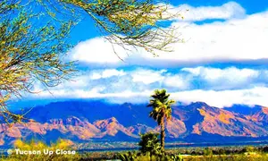
- Mountains Circle Us
Mountains in Tucson AZ
Because of the Mountains in Tucson AZ, the city has been called a "valley surrounded by five mountain ranges."
In a sky-heavy area of town, gradually rotate yourself, and that 360-degree view will give you a near continuous backdrop of rugged peaks. They create a dramatic horizon, which defines the city’s identity.
For visitors, these mountains are more than scenery - they mean the gateways to unique ecosystems, historic sites, and some excellent hiking in the American Southwest. We've built a guide to the majestic ranges that ring the Old Pueblo.
As we're Tucson residents, we designed this to help you navigate your way around saguaro-studded foothills to alpine forests.

1) The Santa Catalina Mountains in Tucson AZ
Tucson’s Crown Jewel
Rising sharply to the north, the Santa Catalina Mountains (locally often called "The Catalinas") are the most eye-catching and popular range in Tucson. Their substantial elevation that peak at over 9,000ft/2,743m is a dramatic escape from the desert.
Tucsonans are particularly happy to Drive Up to Mount Lemmon to get away from summer's heat, and enjoy the outdoors. We'll show you the areas to consider visiting.
 Driving up to the top, or hiking all around - The Catalinas.
Sabino Canyon Recreation Area
One of the most visited spots in the Catalinas is Sabino Canyon Recreation Area. Because of its continuously running creek in these mountains in Tucson AZ, it's a riparian oasis. You'll have wonderful opportunities for stunning photography of its soaring cliffs.
You could take a narrated tram ride into canyon areas. Or if you're a hiker, we recommend the Seven Falls trail. The treat for you at the end is several waterfalls supplying a series of natural pools. It's a fairly easy 8.5mi/13.7km round-trip hike with lots of switchbacks. Believe me - if we could do it (not much into hiking), I'm sure you could!
 Spillway in Sabino Canyon holding back the waters on Sabino Creek.
Catalina State Park
Drive north on Hwy.89 (Oracle Road) to locate Catalina State Park.
From Tucson, you'll find the turn-off on your left. The opportunity here is to hike from the base of the western slopes, the backside of what's seen from Tucson. Yet for birders, local birdlife might be sighted in this sparsley roamed area.
The good-sized campsites have electric & water. We camped one time for a few days in June when our air conditioner was getting repaired. There's also a point of interest at the end of the road.
The Romero Pools trail is a local favorite. It's a moderately challenging trek into these mountains in Tucson AZ. But put in the effort to be rewarded with seasonal swimming holes carved into the granite rock.
My goodness! Take a look at this:
Key Highlight
The Santa Catalina Mountains are a "Sky Island." That's defined by isolated mountain ranges situated on flat lower elevations, where the flora and fauna change rapidly as you ascend. In fact the elevations make it like you're driving from Mexico to Canada in under an hour!
Next Steps: For a deep dive into the highest point of this range, explore our guide on Mount Lemmon Tucson Arizona.
2) The Tucson Mountains: The Iconic Saguaro Forest
To the west of the city lie the Tucson Mountains.
While lower in elevation than the Catalinas, these mountains in Tucson AZ are home to some of the most concentrated and impressive "forests" of giant saguaro cacti in the world. We'll show you what are the top places visitors and locals love.
 Our neighborhood sits in the foothills of the Tucson Mountains.
Saguaro National Park West
 Took our granddaughters on Hohokum Rd, we stopped at an overlook.
The Tucson Mountains form the backbone of Saguaro National Park West. This area is exemplary Arizona desert.
We highly recommend taking Hohokum Road, just under 2mi/3.2km west of the Ranger Headquarters at 2700 N.Kinney Rd. It loops to several exit points. You'll wind through an amazing cactus forest - it's one of the best scenic drives where we take our own visitors. Along the way you can picnic, take any of several trails, and check out some petroglyphs.
If you're not much of a hiker, take a look at the paved nature view trail just opposite Hohokum entry.
If you want one of the best panoramic views of the entire Tucson valley and the west, hike to the top of Wasson Peak (4688ft/1429m). That's the highest point in the range. We did it one time, but didn't reach the top. The trail is a bit rocky in places.
Gates Pass at Tucson Mountain Park
Tucson Mountain Park is in the southwest part of town. There's plenty to do there - See All the Options>
A stunning place to begin, is getting there with a drive through Gates Pass. No hiking necessary! (Although David Yetman Trailhead has access here.) Easy to get there by following Speedway Boulevard west (there's an exit from I-10).
The road winds through jagged volcanic rock and thousands of saguaros. Look for the parking area on the right.
Going to Gates Pass at sunset is a mandatory Tucson experience. But it's popular, so get there early. It's one of the best places in town for a photographic golden-hour view that's been featured in western films.
You can check the timing for the evening sunset range of times: Use This Almanac to Track After-Sunset Timing for the best sunset colors.
 Viewpoint west from Gates Pass
Desert Museum is a Must-See in Tucson
The Arizona-Sonora Desert Museum is nestled in the western foothills of the Tucson Mountains.
Along Kinney Road, west of Old Tucson, it's world-renowned for its living museum experience. The animals (don't miss the hummingbird enclosure), the desert experience - and docents to help you know what to see.
You won't regret a visit there - it's definitely one of our favorite places in town, and your first visit item on your itinerary.
 Several people stopping by a Docent's display for more information.
3) The Rincon Mountains: Rugged and Remote
These mountains in Tucson AZ are on the east side of town.
With a natural, somewhat formidable desert to pines terrain. Much of the Rincons are designated wilderness areas, making them a favorite for hikers and backpackers.
Like a foolish newcomer to town, way back, I went on my own up the Douglas Spring Trail in Monsoon Season! As the day heated up I heard the ratttle of a diamondback going across the trail. I backed away from it, as it glided away. I was sure happy it rattled!
Feeling overheated and very thirsty and hearing thunder, I turned around. Going downhill was more difficult then going up. But I got home and flopped on the bed with a splitting headache and a sunburned face. I said "I'll never do that again!"
If you're an experienced hiker, the Douglas Spring Trail is accessed when taking Speedway Boulevard all the way east.
You can take a side-trail to a waterfall, that's probably the most popular thing to do. A campsite is at trail's end. It's nearly 14mi/22.5km round-trip, a full day's hike.
 Southeast look at the Rincon Mountains taken from Mescal Rd.
Saguaro National Park East
The lower elevations of the Rincons include Saguaro National Park East.
The main attraction is the Cactus Forest Loop Drive. An 8mi/13km paved road perfect for a slow scenic drive or cycling. You'll reach several scenic overlooks and trailheads along the way. Besides the natural Sonoran Desert.
 Along the Cactus Loop Forest Drive
High Country Adventure
The Tanque Verde Ridge Trail, (pronounced tan kay vair dee) for those who have even more audacity.
It's a hardy, steep climb from desert and into juniper and oak woodlands. Reaching the highest point of the Rincon Mountains, Mica Mountain's elevation is 8,664ft/2440.8km. More-so recommended for multi-day backpacking trips.
It's 11mi/3.4km to Cow Head Saddle, where other trails give you further choices. Almost 18mi/5.5m to reach Tanque Verde Peak. It's considered a difficult trek.
4) The Santa Rita Mountains: A Birdwatcher’s Paradise
Located about 40mi/64.5km south of Tucson, accessed from Green Valley Arizona.
The Santa Rita Mountains are famed for Madera Canyon. Known for premier birding opportunites. As already at least 230 bird species of birds have been spotted there.
One thing to do in the Santa Ritas is checking out this Visitor Center
- At the Observatory on Mount Hopkins. With 8595ft/2619.8m, this peak's the perfect place to examine to skies. Fred Lawrence Whipple Observatory has six different telescopes.
- Take in the visitor center (I-19 to Elephant Head Rd, right on Mt. Hopkins) at the western base of the mountains, or schedule a guided tour. See Their Details for Access.

Madera Canyon
This canyon is a cool refuge during the summer months, with snowy views possible in the winter.
A paved road takes you through this delightful canyon. You might catch a glimpse of this rare species, the Elegant Trogon. Birding enthusiasts from around the world come here to try to see it.
Get there from Tucson by taking I-19 south to Green Valley's Exit 63. Go east on Continental Road, turn right onto Madera Canyon/White House Canyon Road. About 11mi/17.7 to arrive.
 You'll be fortunate if you see the Elegant Trojan - birders will be envious!
Mount Wrightson
If you're a fit hiker, take the Old Baldy Trail.
Climbing to the summit of Mount Wrightson (9453ft/2881m elevation), is one you might want to try. The view from the top is awesome. With vistas at every turn, and on clear days you can see into Mexico. It's a difficult continuously steep uphill climb for 5mi/8km.
Not recommended for people like us who went a short ways up and turned around!
 Just looking at Mt. Wrightson's summit you can tell how steep the trail is.
5) The Sierrita Mountains: The Quiet Neighbors
Rounding out the main five ranges are the Sierrita Mountains (pronounced See A Rita) southwest of the city.
Only quiet action here are wing-it trails. You'll travel scrubby oak woodland, chaparral, tall grasses & cacti. Some mountain bike the area. Only suited for late fall to early spring as summer will be brutal - very little shade.
- Keystone Peak, the highest point rises to 6188ft/1886m, the most popular foray.
- Start from McGee Ranch Road, an old maintenance roadway. Steeply upward about 4mi/6.4km.
- Historic mining leftovers are apparent, and one current mine still cuts into the land.
- An unattractive summit has communications towers. But the 360-degree views of the Santa Ritas and Baboquivari Peak are some of the best. Get Your Permit & More Details.
- Placer Peak (5940ft/1810.5m) access means traversing State Trust, BLM, and private land, you'll need permission.
 At Keystone Peak you can get a great pic of Baboquivari Peak, sacred to the Tohono O'odham tribe whose tradition is that the Creator God I'itoi lives there.
Recent posts
-
Tucson Arizona Monsoon Season Guide | Storms, Rain & Travel Tips
 Discover Tucson Arizona monsoon season, including storm timing, lightning, dust storms, flash floods, travel safety, and what to expect during summer in the Sonoran Desert.
Honorable Mention: Tortolita Mountains
On the northwest side of town, they're located between the Santa Catalinas and the Tucson Mountains.
Filled with Sonoran Desert flora like
- Saguaro, cholla and prickly pear cacti.
- Palo verde, ironwood, catclaw acacia, and mesquite trees
- Jojoba, manzanita, shrub live oak, juniper and creosote bushes
- Semi-arid grasslands amidst the chaparral
The highest peak is Jeffords Peak (I believe it's named for Indian Agent Tom Jeffords - you'll remember that name if you watched "Broken Arrow" TV show as a kid.) at 4698ft/1432m. Trails are the attraction in Tortolita Mountain Park and the adjacent Tortolita Preserve.
The semi-easy Wild Burro Trail loops into the Wild Mustang Trail and Upper Javalina Loop. The whole loop trail is 8.4mi/13.5km
 Viewpoint at Tortolita Mountain Park
See What Else is New
-
Tucson Arizona Monsoon Season Guide | Storms, Rain & Travel Tips
Discover Tucson Arizona monsoon season, including storm timing, lightning, dust storms, flash floods, travel safety, and what to expect during summer in the Sonoran Desert. -
Tucson events by interest | Categorized by What You Love
 Looking for things to do? Discover the best Tucson events categorized by your specific interests, from music and art walks to markets and family fun.

Tips for Exploring Tucson's Mountains
Respect the Heat:
Even when reaching the heights of any of mountains in Tucson AZ, the desert sun is intense. Always carry more water than you think you need. At least one gallon per person per day for long hikes.
The 20-Degree Rule:
In ranges like the Catalinas or Santa Ritas, the temperature at the top can be 20 to 30 degrees cooler than the valley floor. Always bring a light jacket, even in the summer.
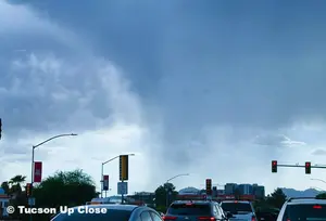
Flash Floods:
During the "Tucson Monsoon" season (Mid June through September), mountain canyons can experience sudden and dangerous flash floods. Always check the weather forecast before entering canyons like Sabino or Madera.
The Takeaways for Mountains in Tucson AZ: More to Explore
The mountains are just one part of what makes Tucson unique.
To continue planning your trip for visual delights around town, read our Places to See in Tucson article.
You might like these
What is Tucson Known For? Heritage Meeting Unique Experiences
When "What is Tucson Known For" is the question, we help you discover Tucson, Arizona's rich history, many cultures, fascinating events & stunning landscapes.
Tucson Public Parks: Discovery Guide to Everyone's Outdoor Fun
Tucson public parks offer something for everyone. Like hiking trails, splash pads, and historical sites. Perfect for budget-friendly fun in the sun!
Southern Arizona Adventures: Beyond Tucson's Borders
Discover the unique charms of cities near Tucson, Arizona, from Marana's desert landscapes to Sahuarita's family-friendly parks.


About the Authors: Karen McGowan is the creator of TucsonUpClose.com, along with her husband Bill. Where they share local details about Tucson Arizona gained from years of living in town. To this day, they actively sample all that Tucson AZ has to offer, so they can help others have a wonderful, relaxing trip - suited to their preferences. Learn more about us.